JUST OFF the Beeline Highway about 25 miles south of Payson, you'll find the Bushnell Tanks Trail, offering eye-popping beauty as Sycamore Creek flows through it. Its big sycamores and cottonwoods were bursting with fall colors in orange, red, yellow, gold and green during our recent hike. Unusually high temperatures made this a beautiful spring hike even in December.
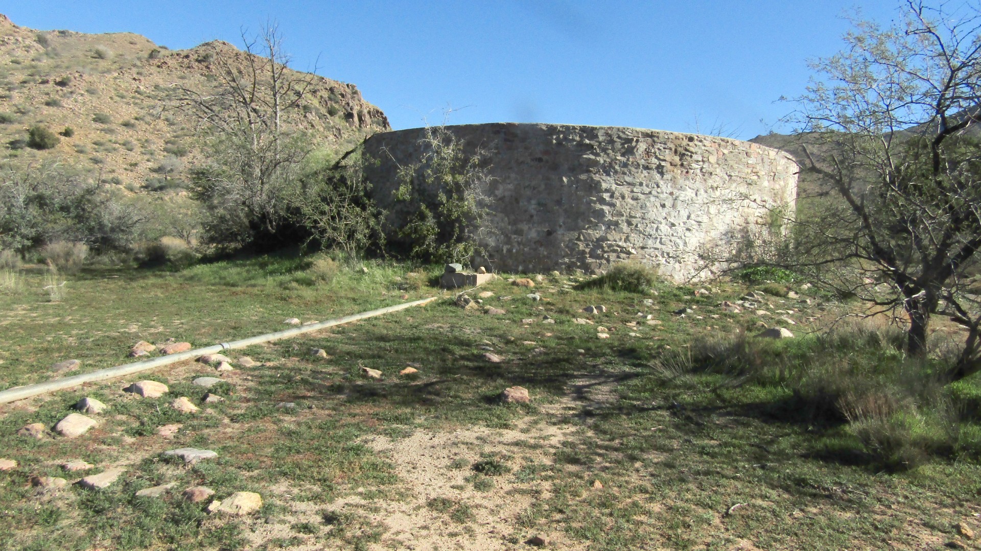
This is a moderate eight-mile hike with the turnaround at the remnants of the Bushnell Tanks. Water was still coming very slowly from the pipes into one of the tanks, so there is still water for cattle and wildlife.
We rock-hopped Sycamore Creek at least five times going in and again coming out, amazed at this little known gem of a trail, on a Saturday with no one around but our Arizona Trailblazers hiking group.
Along the trail there’s a well built horse corral with no horses in it this time, but one of our hikers remarked that they were there last time.
This high-desert ranch country goes through a section of the Arizona Trail. Kudos to Arizona Trailblazer John King, who recently completed the 800-mile trail.
From the parking area near the community of Sunflower — if you blink, you’ll miss it — you go a quarter-mile down a dirt road to a sign across from a wash, just before a cattle guard. That’s where you’ll catch your first closeup of the sycamores and cottonwoods. You yearn to see more of the colors in the trees, and the hike to Bushnell Tanks does not let you down.
It was cool when we set out, but mist was rising from Sycamore Creek before it warmed up. Most of the leaves were still on the trees, but many had fallen to dance in the creek, showing off their wonderful contrast with the flowing stream.
Mt. Ord sits in back of Bushnell Tanks, which offer great views of the mountain. Mt. Ord was where two teenagers where randomly murdered while camping, and this reminds campers and hikers to stay attentive.
You cross the creek and head uphill. There are several small ups and downs on this moderate hike. The elevation change is only 3,350 to 3,700, but with the ups and downs you walk about a thousand feet of elevation.
Then you veer left and head toward a ranch that leads to the corral. From the corral you turn right, followed by a left that runs along a road paralleling the Arizona Trail. There are side trails connecting to other trails, including other sections of the Arizona Trail.
Bushnell Tanks is about two hours and 20 minutes from Prescott, but once you get there you’ll find it’s well wroth the trip.
Usually by this time of year I’m headed south for hiking, because I’m no fan of hiking in the cold, but our warmer weather has been most enjoyable. The West Willow Lake Nature Trail is beautiful. So many leaves have fallen that the trail is carpeted with them, and at some points you see the leaves rather than the trail. But there are still enough leaves to enjoy the extended fall.
After the last set of rainy days a couple weeks back, the water at Willow Lake has risen. Before the rains, from the boat ramp you could walk about a quarter-mile before running into water. Last week the water was within 100 feet of the boat dock. Not deep, but something was there as the geese either flew over or played in the water.
Speaking of water levels, I recently returned to my beloved Bell Trail (not Bell Rock) east of Sedona and, Wet Beaver Creek was gushing. Great to see.
Let me know where you see the water.
Stan Bindell is always looking for a good hike. If you have one, contact him at thebluesmagician@gmail. com
