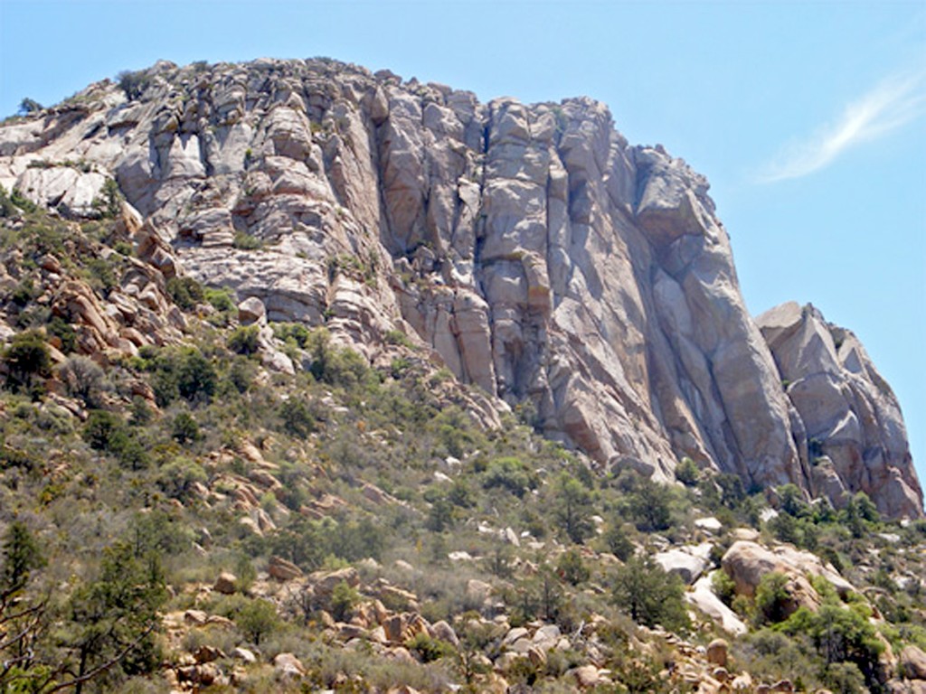
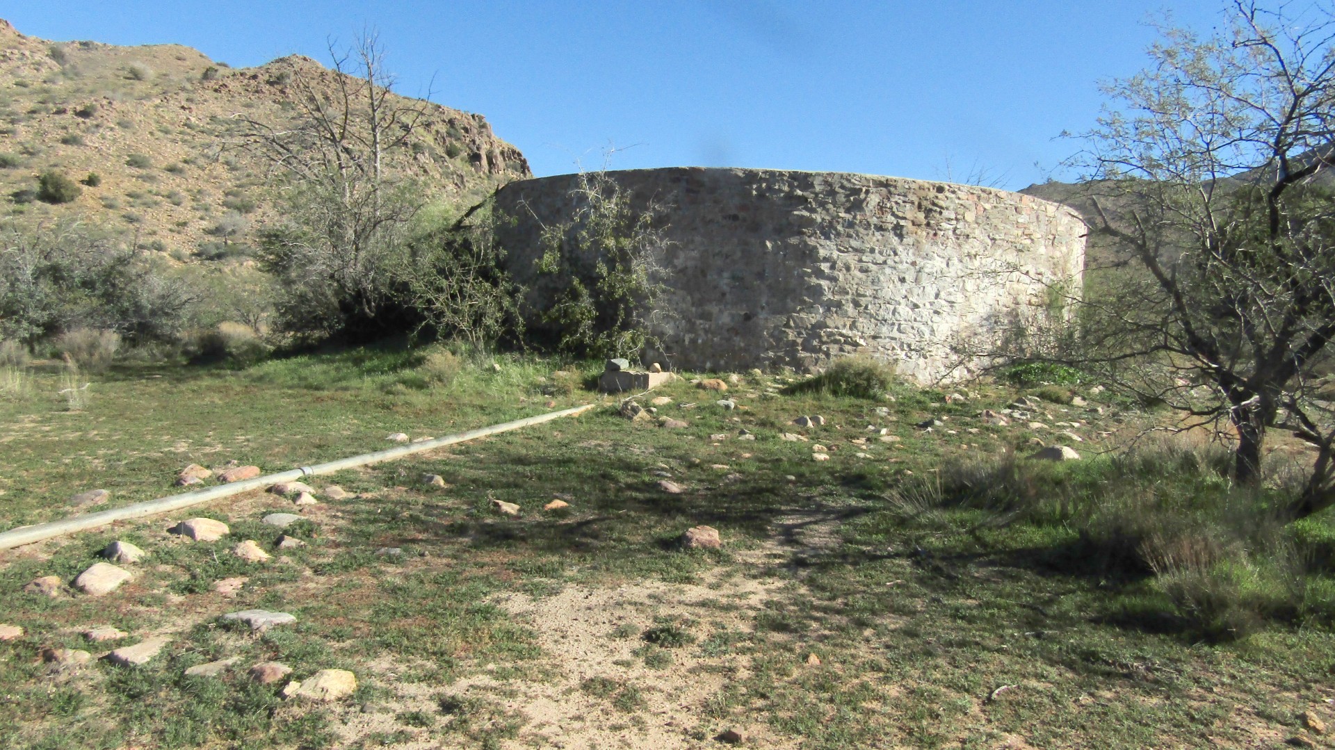
GRANITE MOUNTAIN is best known for its natural beauty, peregrine falcons and the famed Granite Mountain Hotshots.
My nonprofit, Preserving Arizona Wilderness, has just released its latest video, on Granite Mountain. The first part focuses on the mountain’s beauty and the falcons, and includes an interview with Prescott Master Naturalist Dick Yetman. The second part is about the Hotshots, featuring an interview with John Marsh, father of Eric Marsh, one of the 19 firefighters who died in the Yarnell Hill fire. Check out the videos here and here.
Much to see
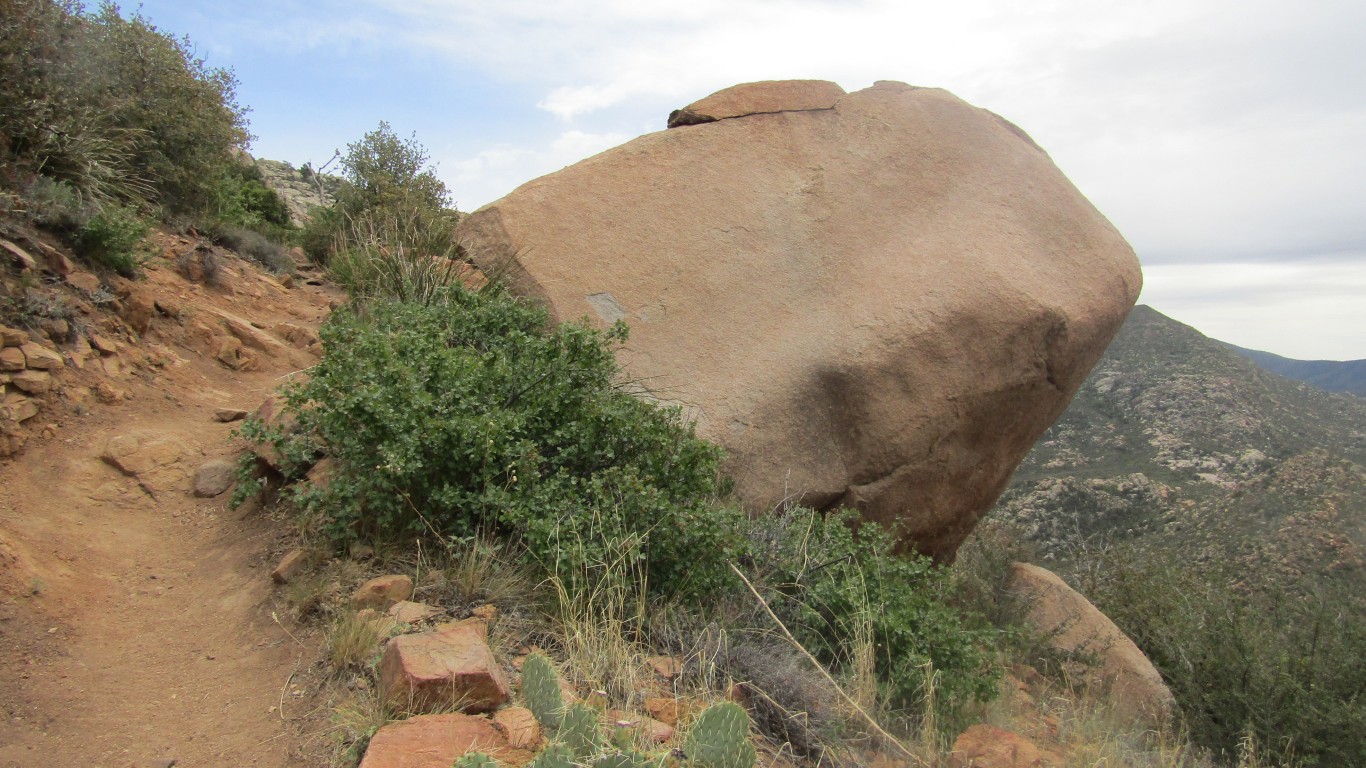
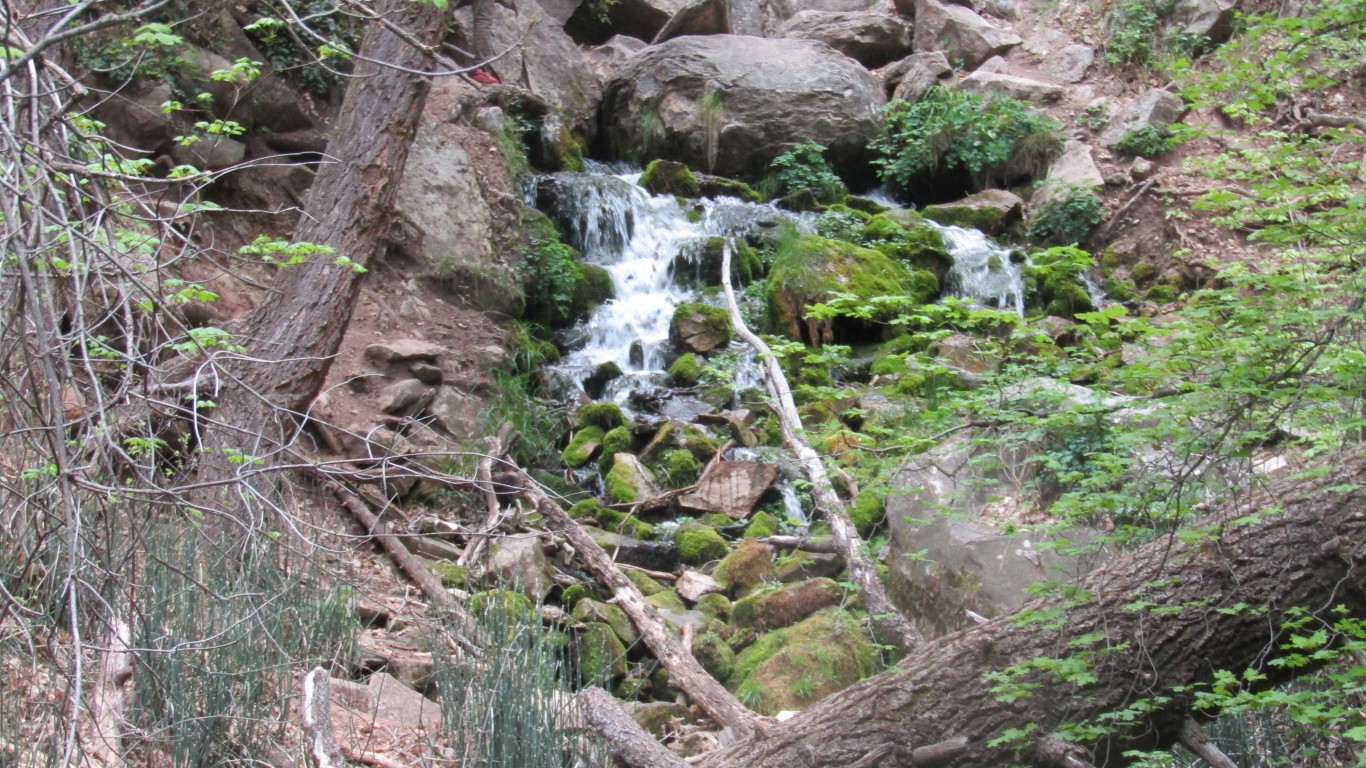
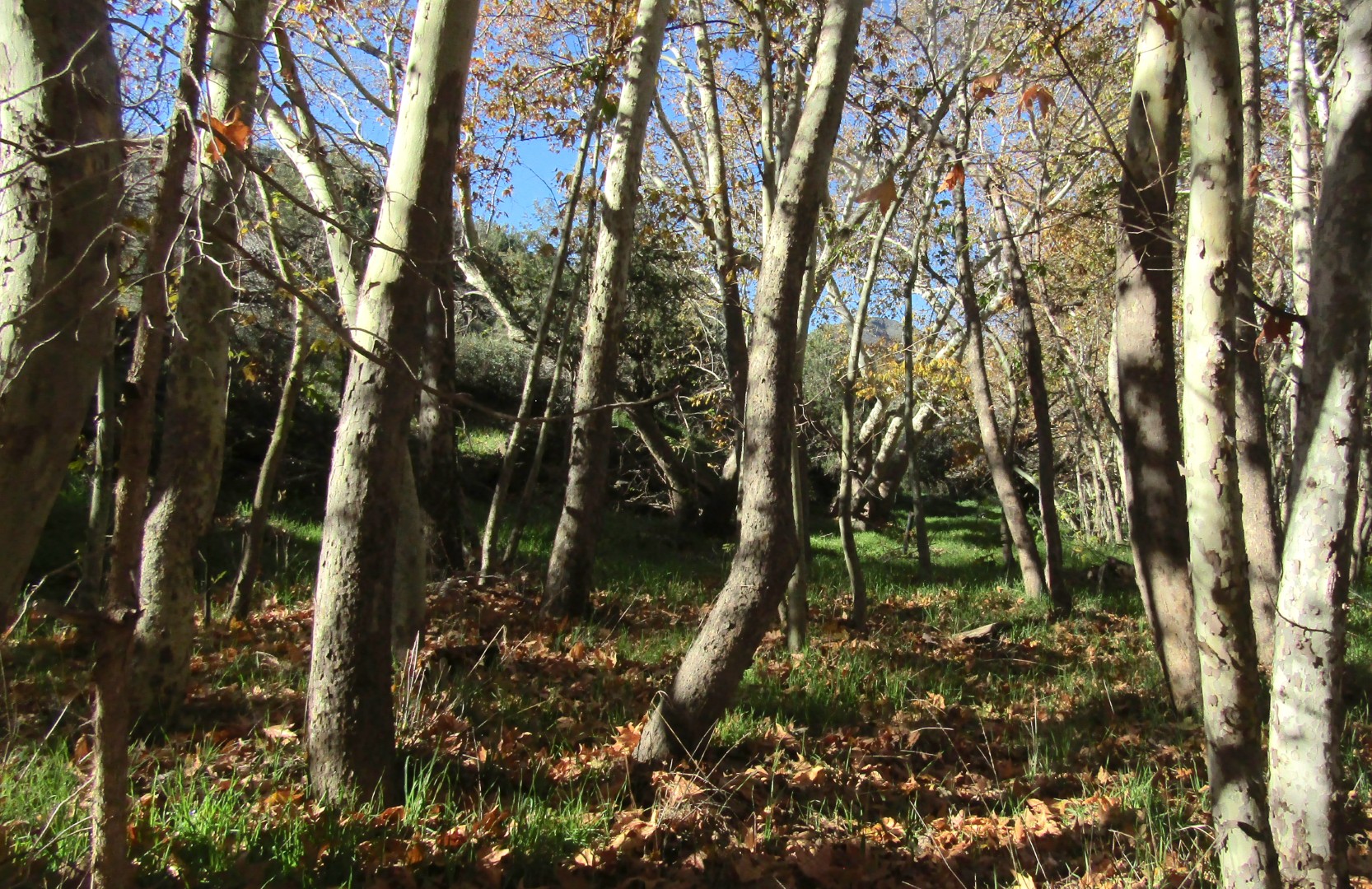
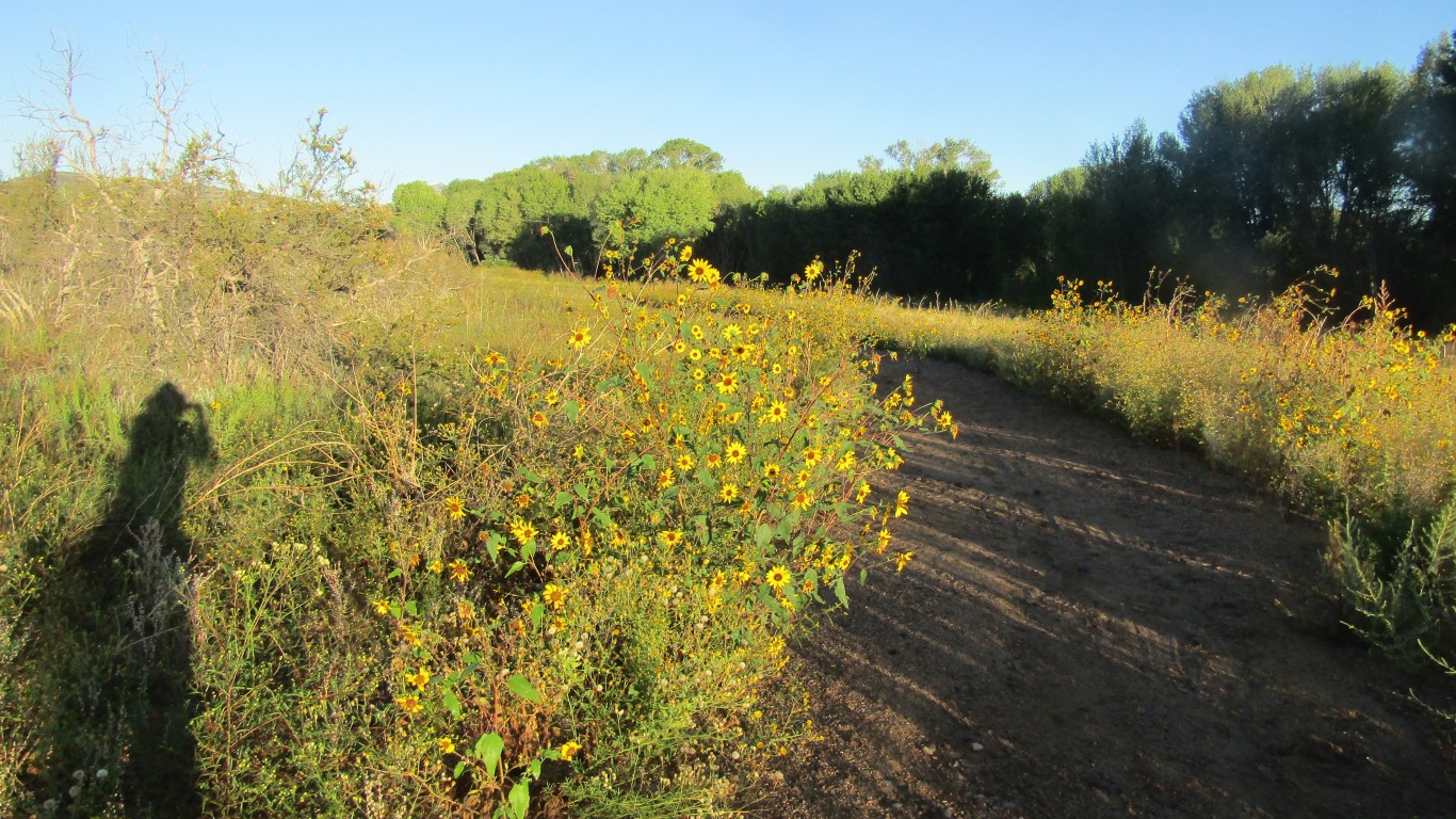
Ragged boulders, some as big as a house, stack on top of each other to an elevation of 7,626 feet in Granite Mountain Wilderness. Some are hiking Granite Mountain for the first time, others have been hiking there for more than fifty years. The striking landscape, amazing rock formations and views are all great reasons for preserving the wilderness. Managed by the US Forest Service, it covers 9,970 acres and includes more than ten miles of trails.
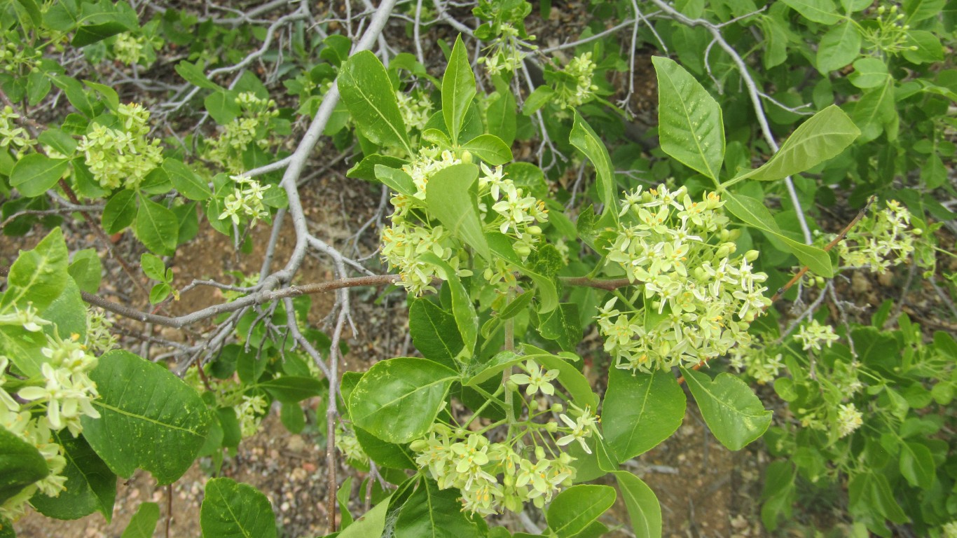
Chaparral, a community of plants including shrub live oak, mountain mahogany, manzanita and lemonade berry bush, dominates the southern slopes, with scattered stands of piñon and juniper. On northern slopes you’ll also find piñon, juniper and some pine and oak higher up.
Mule deer and javelina inhabit the area, along with a mountain lions, bobcats, badgers, foxes, skunks, coyotes, rabbits and smaller rodents.
Hikers, horseback riders and hunters may be found here in abundance, on three trails totaling twelve miles.
Granite Mountain is popular among rock climbers for its sheer cliffs. Hikers walking along the south face get an impressive view of the cliffs soaring above them.
Falcon refuge
People debate whether the peregrine falcon is among the most beautiful birds, but what you can’t argue with is its speed. This bird of prey has a blue-green back, white underparts and a black head. Audubon calls the peregrine one of the fastest birds in the world, and National Geographic TV has clocked one at 242 miles per hour. It averages a twenty-year lifespan, is 13-23 inches long and has a wingspan of 29-47 inches. Because of the nesting sites the Forest Service closes off the cliff areas of Granite Mountain from February to July.
Challenging summit
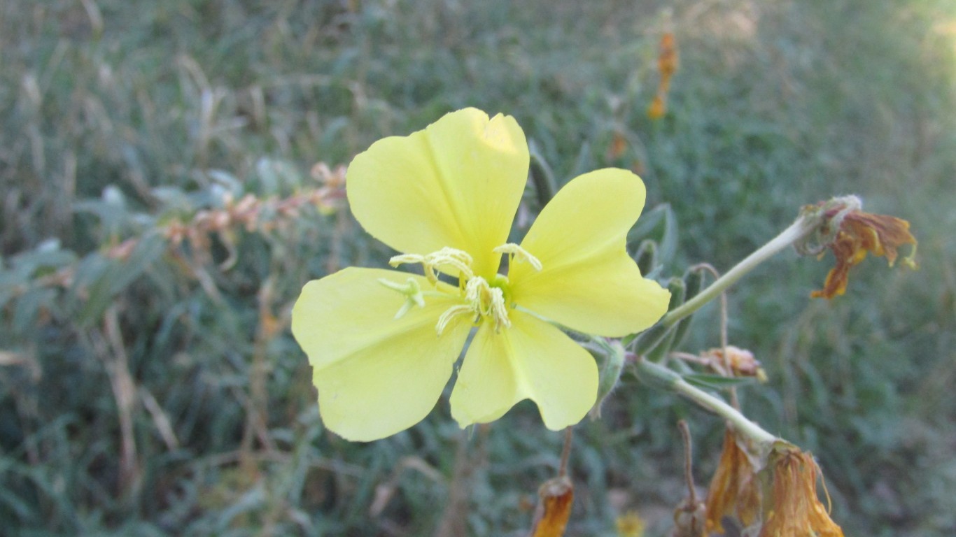
Going to the saddle is a great moderate hike, climbing about 1,600 feet, offering great views and covering 7.6 to 8.2 miles, depending on which parking lot you choose. The first 1.75 miles go through a forested area with oak and maple trees. The trail is known for verbena, penstemons and many other flowers. Red thistle on the mountain entices hummingbirds.
After the saddle, the trail intermittently disappears, meaning lots of climbing up boulders, including for route-finding, involved bushwhacking and rock-scrambling. Maneuvering up these rocks offers many chances for injury, so don’t do this alone. I was with twelve other members of the Prescott Hiking Club, and several of them helped me make it to the top some years ago.
Getting to the top, at 7,600 feet, is most rewarding, not only for accomplishing what most people on this trail don’t do, but it also offers a 360-degree panorama of the many surrounding mountains, including the San Francisco Peaks, Kendrick Mountain, Bill Williams Mountain, the Bradshaw Mountains and Sycamore Canyon.
A fun side trip is to the famed alligator juniper that the Granite Mountain Hotshots rescued from the Doce Fire in 2013. This tree is believed to be the largest and oldest of its kind, over 2,000 years old. Today people honor the Hot Shots with memorials left at the tree.


ONE of the trails in the Red Rock/Secret Canyon Wilderness in Sedona wakes you up with its vibrant colors: Loy Canyon.
During a recent hike I saw twelve flower species in bloom. The reds and yellows jump out at you first. Then you start to notice the lupines and larkspurs. The Sedona red rocks ahead make for a great background. But this is where the Loy Canyon Trail can trick you. The first three miles are relatively easy, with no indication of what you’re approaching or the energy you’ll need for it.
This is a ten-mile hike, five in, five out. At about the three-mile mark you come to a cavelike indention in the canyon wall. If you turn around here you’ll have had a leisurely six-mile hike.
If you don’t, you’re in for a workout. Loy Canyon Trailrises from 4,677 to 6,400 feet, the vast majority of it in the last two miles. The first three miles offer a decent amount of shade; not so on the last two. The trail is steep and you’re walking or scrambling over steps of broken boulders. The people who built this trail had a sense of humor.
The work is rewarding, though, and the farther you go up the trail, the better the views. Loy Butte is straight ahead, with Secret Mountain reaching up behind it.
A nice factor for this trail is that it’s accessed via Sedona back roads, offering two benefits. First, not that many people use this trail, so, unlike so many other Sedona trails, it’s not overcrowded. Second, while we did hear a couple of helicopters, is it’s not overrun with tourist helicopters the way some trails are in the area.
The Loy Canyon Trail is known for Stellar’s jays. I didn’t see any on this trip, but hey were there last time, and the odds are good you will see some.
Shortly into the trail you come across a sign letting you know you’re passing through part of Hancock Ranch. There is a wire fence with the ranch on the other side, and the easement allows hikers to pass through, but you’ll still want to be respectful. Regardless of whether you’re on the ranch property, remember the hiker’s creed: leave no trace.
The lower portion of Loy Canyon hosts scrub oaks, Arizona cypress, yuccas and prickly pear. The upper portion has alligator junipers, Ponderosa pines, gambel oaks and firs.

The 47,195-acre Red Rock Secret Mountain Wilderness is home to a broad range of local wildlife — elk, mule deer, white-tailed deer, javelinas, coyotes, rabbits, mountain lions and black bears. Common recreational activities include horseback riding, photography, wildlife viewing, swimming and hiking.
The many trails in the wilderness include Vultee Arch, Dry Creek, Sterling Pass, AB Young, Secret Mountain, Wilson Mountain, Fay Canyon and Bear Mountain.
Arizona has 90 wilderness areas, and for us it’s great to have Red Rock Secret Canyon Wilderness nearby.
Getting there
From the roundabout junction of State Rt 179 and State Rt 89A in Sedona, drive south on 89A for 9.7 miles to Forest Road 525, turn right on FR 525 and continue 9.5 miles to the trailhead. For more info, call the Red Rock Ranger District at 928-282 4119.
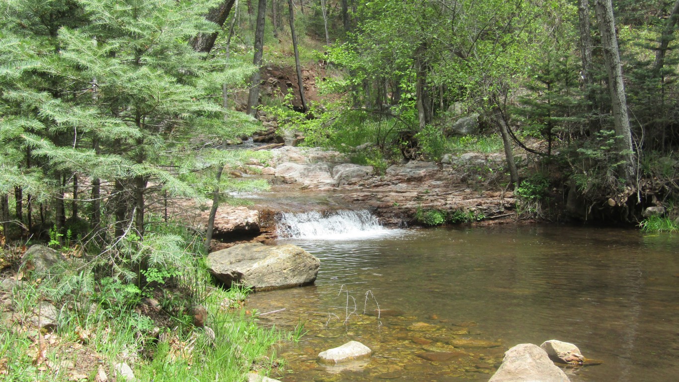
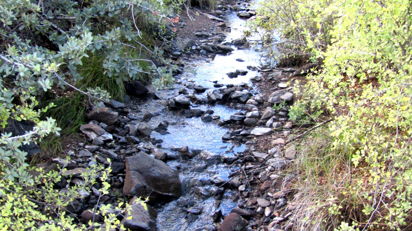
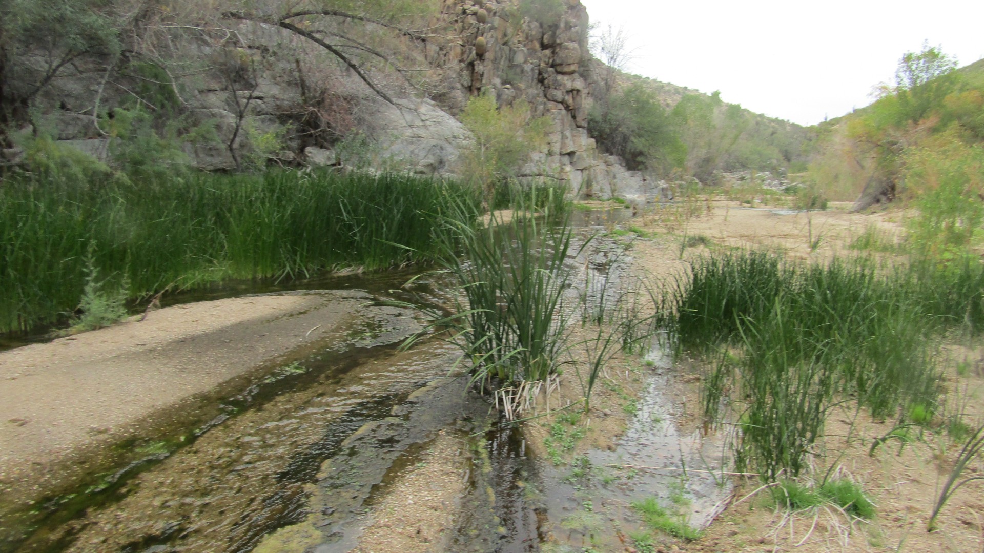
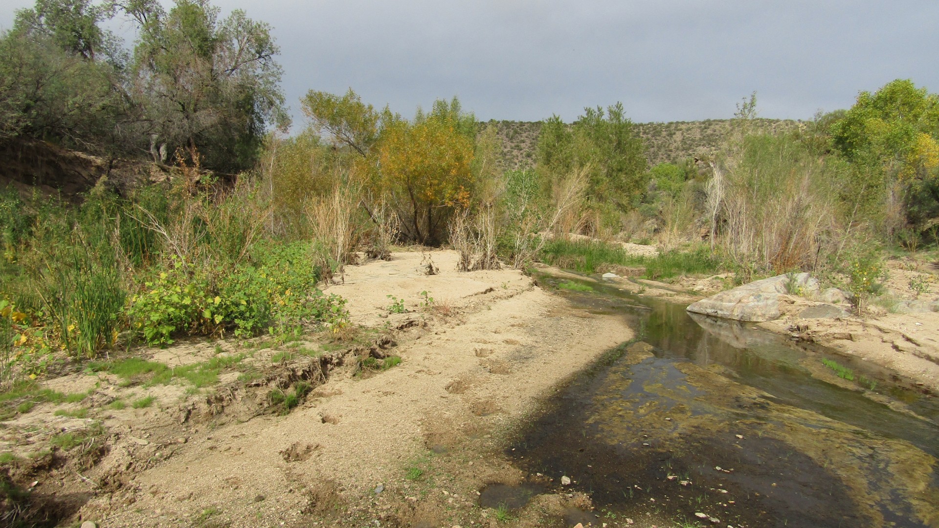
JUST EAST of Payson, Horton Creek offers a fast-flowing riparian environment with wonderful cascading water, something we don’t find in many places around Arizona. That makes the trail popular among the Arizona Highways Hiking Guides list of top day hikes. Prescott offers Watson, Willow, Goldwater and Lynx Lakes, along with Prescott’s mostly seasonal creeks.
Horton Creek runs year-round and rises as a spring four miles in, and the turnaround point for most hikers. Horton Creek Trail connects with the 40-mile Highline Trail, so you can do as many miles as your feet will let you; we saw several backpacking parties pass.
The eight-mile hike that most are doing is considered moderate. It rises from 5,360 feet to 6,700, so it’s not a flat walk in the park. Still, many kids and adults do it, many during the summer to feel the cool water and experience the abundance of flowers. We did it in mid-April, when it was still cool and the flowers were just beginning. Even so the trail was packed with friendly, happy people enjoying the sheer beauty of Horton Creek.
Some tree stumps along the trail serve as great places for snacks, lunch or just places to rest and take it all in.
The creek becomes more prominent about two miles in. There are many places to get down to the water, and boulders offer spots to just kick back and maybe take a nap.
During summer Horton Creek is a paradise, filled with a dozen types of flowers: columbine, yellow bells, monkey flower and daisies tantalize the hiker, and lupines, wild roses and other species easy to spot. Oaks, cottonwoods and sycamores offer plenty of shade on most of the trail to help cool off, another major enticement.
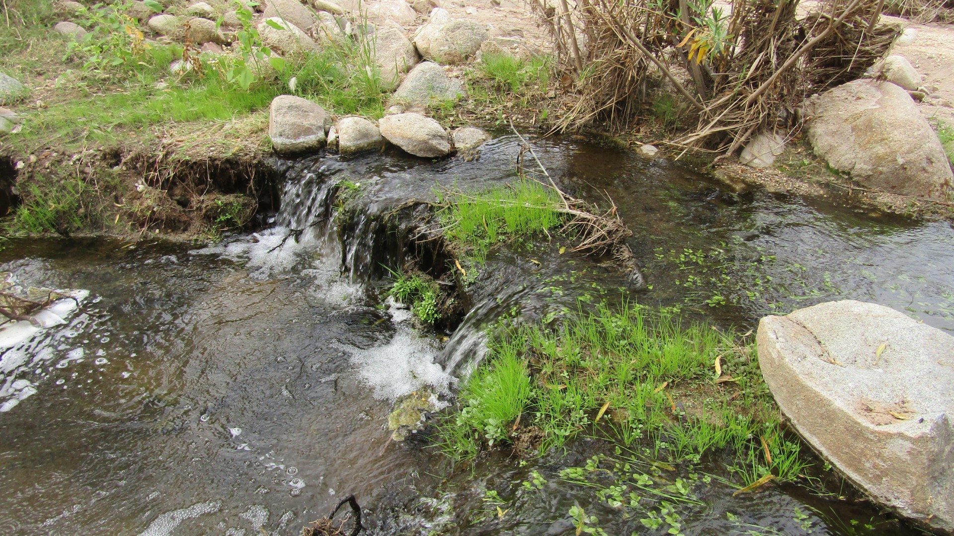
Most of the Horton Creek Trail was built on an old jeep trail, making a good foundation, but one part of it traverses a scree of small rocks, so I advise hiking boots. The gem at trail’s end is Horton Springs, where the water comes down a mossy, 30-foot slope and flows into the creek.
Overnight camping in the area is a good option. On this outing we saw plenty of camping tents.
Hikers usually park at the Tonto Creek Campground, but it’s currently closed for renovation, so park at the Dedrick trailhead, and on weekends you’ll want to get there early, before there are no spaces left.
Just before reaching the spring, the old jeep road offers a view of the Mogollon Rim straight ahead. This is an awesome sight, but keep your eye on the trail, because this also the part of the trail where’s you’re most likely to spot a rattlesnake.
The trail leads right up to what appears to be the end of the creek, but don't stop here or you'll miss Horton Springs. Another 100 yards to the east you’ll find the spring’s mossy green waterfall. It's fun climbing to the top, but be careful on the slippery moss.
The climb is gradual, so not noticeable during most of the trail. The steepest part comes about three miles in. The last time I hiked this trail, in 2012, I hardly felt the elevation. This time I stopped often for rest breaks going on.
Birds at Willow Lake
Willow Lake continues to be a birder’s paradise. You’ll see owls, cormorants and herons along the nature trail. By the lake you may find northern harriers, black hawks, killdeer and red-winged blackbirds. I hear amazed birders talking about their new finds nearly every time I visit.
Video on Munds Mountain Wilderness
Our Preserving Arizona Wilderness video is out on YouTube, view it here.

Just one time hiking the Watson Lake Loop Trail and it becomes obvious why the Dells must be preserved as much as possible.
The Watson Lake Loop is one of the most popular for those who live here, but with more folks moving into the area, it’s a treat to show this trail to those who haven’t been on it previously.
I recently hiked it with first-timer Wayne Kramer. We sat on a bench overlooking the serene water and the Dells on the other side. Kramer marveled at the beauty and was convinced that he made the right decision in retiring here.
The five-mile loop trail captures the beauty of the Dells and connects with many others, taking you as far as you want to go. Our pleasure on this day was to connect with the Peavine Trail and then to the Iron King Trail, with its old train engine as our turnaround point, making an eight-mile hike.
The Watson Lake Loop climbs and descends some steep, rocky terrain as hikers scamper over the Granite Dells boulders. Kramer was thankful for the white dots showing us the way, mentioning that the trail would be hard to follow without them. I agree!

The area’s rock formations are marvelous, and can be fun to climb. The birds and wildlife add allure to this trail. Ducks greeted us when we started the trek, and we were treated to an eagle in flight on our way out. Herons, egrets and other birds add to the scenery.
Nearby Willow Lake is a birder’s paradise, the cormorants and herons having returned for the season. One cute owl with babies is bringing the birders out in droves. The daddy owl just made an appearance. Deer and javelina are not uncommon on these trails as well.
The Watson Lake Loop includes parts of four other trails, but the most common point to start from is the North Shore Trail, not far from the Watson Lake Park entrance. There is a parking fee to enter, and there are plenty of bathrooms and ramadas for shady relaxing or eating lunch.
The elevation change is minimal, starting at 5,075 feet and topping out at 5,237, though that can be deceptive because there are several small ups and downs.
Starting from the north shore you’ll quickly get into the boulders, including Balancing Rock, where some practice their bouldering skills.
In about a half mile you’ll come to a small overlook, where you can see the top of the dam, built in 1900 when the Chino Valley Irrigation District was formed. Soon after you begin the descent. From the bottom you’re looking up at the dam.
You’ll see some wonderful streams with cattails and a nice riparian area. A little footbridge takes you across, and side trail leads from the bridge to just under the dam.
The Over the Hill Trail takes you back to the Dells, passing spectacular trails along the way. One leads down to Secret Cove for those who want to add just a tad more mileage. Granite Mountain is off in the distance.
The Lakeshore, Peavine, Discovery and Watson Lake trails all come together to help the hiker complete this loop.

HIKING THE Woods Canyon Trail in the Munds Mountain Wilderness in mid-February was freaky good because the weather was unusually warm, yellow flowers were starting to come out and butterflies were dancing around me.
Videogaapher Titian Beltran and I were shooting video on the Munds Mountain Wilderness that will be out on my YouTube page Preserving Arizona Wilderness this month. A month ago Wet Beaver Creek was gushing like a river, but with the lack of rain it was much more serene on this trek.
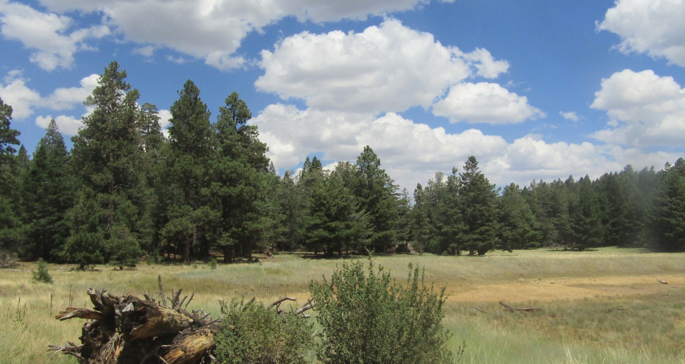
Munds Mountain Wilderness is worth preserving for its red-rock formations, high mesas, cliffs, slopes and deep canyon drainages, and it’s particularly well known for its Coconino and Supai sandstones.
The 14 trails in Munds Mountain Wilderness offer a range of opportunities for sun and shade. Some of the other trails include Jacks Canyon, Schnebly Hill, Bell Rock, Marg’s Draw and Courthouse Butte. Sedona landmark Bell Rock is here as well.
The wilderness area is also known for its many archaeological sites. Native Americans consider the area religiously significant, so there are signs asking us all to respect these sites, listing legal ramifications that include fines for vandalism.
Most of the sites in the area were built by the people known archaeologically as the Southern Sinagua, who occupied them from about 1150 to 1300ACE. Some include artifact scatters consisting of pottery and lithic artifacts from foraging and processing activities. Other sites consist of small masonry fieldhouses that were part of the agricultural system. The most prominent sites are multi-room masonry pueblos on the edges of towering canyon walls. These sites have typically been considered fortifications, suggesting conflict near the end of the prehistoric period. None has been scientifically excavated, so this interpretation is still an open question in modern archaeology.
Munds Mountain Wilderness, established in 1984, starts at 3,600 feet of elevation and climbs to 6,800 feet, covering 18,109 acres.
Fire has had little impact here because the area is close to Sedona, so fires are put out quickly.
Trees in Munds Mountain include sycamores, Arizona cypress. pinyon juniper, mixed conifer, Ponderosa pine and gambel oaks. There are no perennial streams in the area, and surprisingly there are no invasive weed species. Arizona bugbane, a rare plant, thrives here.
Area wildlife includes black bear, elk, mountain lion, whitetail and mule deer, rabbits and coyotes. Mexican spotted owls, peregrine falcons, wrens, scrub jays, Stellar jays and Gambel’s quail are among the many birds.
Woods Canyon Trail
Woods Canyon Trail is one of the best because Dry Beaver Creek runs along part of the trail, and the further you go on the trail, the more you see the creek. During the first two or three miles there isn’t much water. Then the Munds Mountain Wilderness sign appears.
Woods Canyon Trail is an easy eight-mile hike. The trek to the Munds Mountain Wilderness sign is fairly flat, then there’s a bit of a descent and shortly after that you’ll come to Dry Beaver Creek.
At some points Dry Beaver Creek is running pretty strong, with water cascading like mini-waterfalls. The water appears to hardly be moving in other sections, and will tempt swimmers on warmer days. The hike begins at the Sedona ranger-station parking lot, where restrooms are available. Shortly into the hike you’ll walk are along an old jeep road.
For those who want more mileage, Woods Canyon Trail connects with Horse Mesa and Hot Loop Trails. A sign warns hikers that Hot Loop Trail is especially rocky and strenuous; several hikers have been rescued from this trail over the years. About a quarter mile from the wilderness sign hikers can walk or take breaks on large downed trees. The reward comes about 4.5 miles in when you’ll come to huge bounders overlooking Wet Beaver Creek where its water is highest. This is a great place for lunch.
In Day Hikes of Sedona I read that the trail is named for Fred Woods, who kept sheep in the canyon in the 1880s.
Book-signing
I hope you’ll join me at 2pm on March 7 for my book-signing and reading of my environmental-adventure novel Falling Into Congo, at Peregrine Book Store on North Cortez St. in Prescott.

I LOVE water hikes, especially new water hikes. I also love hiking clubs because they help me find the new water hikes. So here are two new-to-me water hikes with two different hiking clubs.
First is the Not the Jail Trail in Cottonwood, with the town’s Skyliners Hiking Club. Naturalist Chris Jensen led this hike, and he showed us three diversion dams.
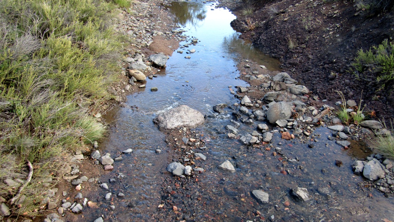
You’ll pass by and cross a section of the Verde River during the Not the Jail hike, as these dams divert water from the Verde to the lagoons at Deadhorse State Park. One of the dams is not far from where you can cross the Verde to find your way into Tuzigoot. The Verde flows pretty strong in this section, and eating lunch while sitting on big rocks watching the water cascade is mesmerizing.
The Not the Jail Trail is an in-and-out hike of about five miles round-trip, and features varying foliage with little elevation change. Hikes don’t get much flatter or easier than this. There are several small footbridges that cross the water. One is so small you can hardly stand on it to cross it.
The hike begins at the Jail Trail head in Old Town Cottonwood. You’ll walk a short distance to a wooden footbridge, cross and go another 20 yards to a sign that points to the Jail Trail on the right. There is also a well established trail that takes off to the left as the Not the Jail Trail begins. Jensen estimates that he’s hiked this trail 500 times. I’m not planning to challenge that record, but it’s a fun trail that I wouldn’t mind returning to. Any trip to the Verde is worthwhile.
Deer Creek Trail
Deer Creek was flowing strong, not deep but certainly wide, with a lot of cascading water. This hike was with the Arizona Trailblazers, Vickie Johnson leading the way.
The Deer Creek Trail is about 20 miles south of Payson, a bit more than a two-hour ride from Prescott. It’s part of the Arizona Trail. This is a moderate hike of eight miles.
The trail offers an approach from the east side of the Mazatzal Mountains. It crosses rangeland to Deer Creek, then follows it upstream for about four miles. There are many places to stop and cool off in the creek or enjoy a snack.
Starting a few miles south of the Barnhardt Trail off Highway 87, the Deer Creek scenery features desert cactus varieties mixed with high-desert scrub. Like the Not the Jail Trail, there are plenty of cottonwood and sycamore trees along the gurgling creek, replete with boulders.
After less than quarter mile Johnson pointed out a variety of colorful rocks in deep purple, red, blue, gray and orange, evidence of nearby mining activity.
For those looking for more miles, the hike passes trail #47 (Gold Ridge) and #46 (South Fork) before it is introduced as Trail #45 (Deer Creek) about a mile in, offering some shade. Following the contours of a little canyon, the trail winds back and forth between the creek and canyon walls, with ups and downs of between 50 and 100 feet.
On the last leg out, when the temperature was about 70 degrees, we came across a single orange poppy. Who finds a blooming poppy in January?
Another highlight of the trail is a bit more than 2.5 miles in you’ll come to the Davey Cowan headstone. He was buried there in 1926.
Book note
I hope you’re reading my new novel Falling Into Congo, and you’ll come to a reading and book-signing, scheduled for 2pm March 7 at Peregrine Books on north Cortez Street downtown.
JUST OFF the Beeline Highway about 25 miles south of Payson, you'll find the Bushnell Tanks Trail, offering eye-popping beauty as Sycamore Creek flows through it. Its big sycamores and cottonwoods were bursting with fall colors in orange, red, yellow, gold and green during our recent hike. Unusually high temperatures made this a beautiful spring hike even in December.
This is a moderate eight-mile hike with the turnaround at the remnants of the Bushnell Tanks. Water was still coming very slowly from the pipes into one of the tanks, so there is still water for cattle and wildlife.
We rock-hopped Sycamore Creek at least five times going in and again coming out, amazed at this little known gem of a trail, on a Saturday with no one around but our Arizona Trailblazers hiking group.
Along the trail there’s a well built horse corral with no horses in it this time, but one of our hikers remarked that they were there last time.
This high-desert ranch country goes through a section of the Arizona Trail. Kudos to Arizona Trailblazer John King, who recently completed the 800-mile trail.
From the parking area near the community of Sunflower — if you blink, you’ll miss it — you go a quarter-mile down a dirt road to a sign across from a wash, just before a cattle guard. That’s where you’ll catch your first closeup of the sycamores and cottonwoods. You yearn to see more of the colors in the trees, and the hike to Bushnell Tanks does not let you down.
It was cool when we set out, but mist was rising from Sycamore Creek before it warmed up. Most of the leaves were still on the trees, but many had fallen to dance in the creek, showing off their wonderful contrast with the flowing stream.
Mt. Ord sits in back of Bushnell Tanks, which offer great views of the mountain. Mt. Ord was where two teenagers where randomly murdered while camping, and this reminds campers and hikers to stay attentive.
You cross the creek and head uphill. There are several small ups and downs on this moderate hike. The elevation change is only 3,350 to 3,700, but with the ups and downs you walk about a thousand feet of elevation.
Then you veer left and head toward a ranch that leads to the corral. From the corral you turn right, followed by a left that runs along a road paralleling the Arizona Trail. There are side trails connecting to other trails, including other sections of the Arizona Trail.
Bushnell Tanks is about two hours and 20 minutes from Prescott, but once you get there you’ll find it’s well wroth the trip.
Usually by this time of year I’m headed south for hiking, because I’m no fan of hiking in the cold, but our warmer weather has been most enjoyable. The West Willow Lake Nature Trail is beautiful. So many leaves have fallen that the trail is carpeted with them, and at some points you see the leaves rather than the trail. But there are still enough leaves to enjoy the extended fall.
After the last set of rainy days a couple weeks back, the water at Willow Lake has risen. Before the rains, from the boat ramp you could walk about a quarter-mile before running into water. Last week the water was within 100 feet of the boat dock. Not deep, but something was there as the geese either flew over or played in the water.
Speaking of water levels, I recently returned to my beloved Bell Trail (not Bell Rock) east of Sedona and, Wet Beaver Creek was gushing. Great to see.
Let me know where you see the water.
If this was my ranch I'd be too busy hiking the riparian area to get anything done.
While Savannah and Ryan Barteau can’t do that because this is their family’s working ranch, they do see the value of the riparian area and have applied for a conservation easement to protect it from development or sale.
Recently Savannah was happy to take time off to lead a few Sierra Club members on a short hike through that riparian area, which is open to hikers. Savannah asks only that we give them a heads up when we’re coming. “We love people and like to see them come out,” she said.
We only hiked about 1.5 miles, but you can hike seven miles round-trip from the ranch to the neighboring property line. Plan on getting wet, maybe up over your boots, as you’ll be walking through the stream.
This part of the stream appears to be flowing year-round; the lower part is underground except during particularly heavy rain.
On our short hike we were able to see a couple of tortoises, blue-jay feathers as they were passing through, and the last remaining butterflies before colder weather sets in.
That’s only a hint of the range of wildlife the Barteaus have seen here over the years. Turkeys, black bears, javelinas and bobcats are among the many visitors, along with a wide array of birds — Eric Moore of The Lookout leads bird tours here at least once a year.
This is the northernmost area for seeing grey hawks, and several zone-tailed hawks maintain nests here.
The fall colors were out during our hike among the wide array of tree species, including cottonwood, ash, and mulberry, and don’t miss the blackberry bushes.
Arizona Game and Fish has been out here to survey the stream’s dace and other fish. We had the opportunity to see a whole school of dace.
The conservation easement that Date Creek Ranch has been working on for more than two years involves federal and state funds to protect the area while current uses, including ranching and agriculture, continue. The ranch covers 3,800 acres, and the protected riparian area within is about 600 acres. The conservation easement will keep that from being sold in the future.
Phil Knight purchased the ranch in the 1960s, but it goes back much further than that: the family has converted a 1910 building into a bed and breakfast where people can enjoy the ranch and riparian area.
In the 1990s the ranchers reintroduced beavers to Date Creek, and now there are healthy beaver dams. They see the beavers occasionally, but we missed them on our hike.
Savannah likes to point out the little guys in the riparian area, which includes cucumber beetles.
Savannah married into the ranching family eleven years ago and now, having found her slice of heaven, she doesn’t want to be anywhere else.
She said that one of the amazing things about Date Creek is watching it change with flooding. It exhibited 500-year floods in 1999, 2002 and 2004. Trying doing that math!
The pending conservation easement is a great example of how ranchers can work with the environment. Make no mistake, this is a working ranch, with cattle, sheep and chickens, not to mention the friendly, oversized dogs and a couple of cats who like to cuddle. The ranch sells its premium meats.
Steffan Wolf, Ryan’s stepdad who married into the ranching family years ago, said the Forest Service supports the conservation easement, but it’s on hold till the government approves the grant. The recent federal shutown has delayed it further, but Wolf expects it to be approved within a year.
“It’s just a matter of working out the details,” he said. “It’s pretty far along in the process.”
Date Creek Ranch is 90 minutes from Prescott, still in Yavapai County. For more information, phone the ranch at 928-231-9058.

How can the Willow Lake Loop Trail turn into a misadventure? Rain impacts where most hikers, including myself, hike. If it’s going to be heavy rain, particularly in areas that flood, hiking groups will postpone hikes. I’m always adjusting my hikes due to weather.
The recent rains have caused a number of changes. My mad-scientist hiking buddy and I were going to hike the Javelina Trail, but rain was expected, so he called an audible and we decided to do the Willow Lake Loop Trail, which is considerably shorter.
We decided to take a side trail to get to Willow Lake Loop, but it came to a dead end, so we decided to scramble over boulders. The good news was it gave us a great view of the dam and the deepest part of the lake.
When we came down on the other side, and he came down first, he got stuck in the mud. Literally. Almost like quicksand. He was able to get himself out, but his boots didn’t come out with his feet. I wish I’d taken a photo. Not wanting to get stuck again, he put his science brain to work, gathered some branches and built a bridge to get back to his footwear. He was able to put them on despite the muck on them. Then we were able to slog half a mile through a riparian area full of tall weeds to reach the Willow Lake Loop Trail. We made it to an area with a beautiful view, looking down at the dam as it started to rain. We turned around.
Following rainfall on another day and still under perilous clouds, I decided just to walk the Upper Willow Lake neighborhood. From Samantha Street you see Vista Park, which looks so small that if you sneeze you’ll fly by it. It didn’t look very inviting, but I noticed a trailhead there, and figured I’d see whether it was muddy, and if not I’d rock on. The graveled path was good, but more important was what I heard: cascading water.
I followed the sound for just a couple of minutes and there it was, a running stream. The first spot was only a few feet wide, but the more I followed it the bigger it got, till I found a stretch that’s six to eight feet wide. It eventually led to a nice footbridge crossing the creek at its widest. This leads to the other side of Vista Park, which comes out on Sarafina Street, and has a playground, restrooms and ramadas where you can hide from the weather when it’s raining or just hang out when it’s nice.
Another part of this great find is a series of small trails from here, with all sorts of trees, bushes and flowers making this a real gem. The trails are mostly used by dog-walkers and immediate neighbors. The trail is equipped with plenty of benches, many shaded by trees or little roofs. This isn’t one of my beloved wilderness trails, but when you can’t go that far, this is nice place to enjoy nature close to home.
The Vista, Sarafina, Hawkeye Loop and Panorama trails are all short for leisurely walks, and can be strung together for a workout of several miles. This is part of the Prescott Parks Department system. Keep exploring and check out that unknown trail, you never know where it might lead!
West Willow Nature Trail in Prescott and Griffith Springs just south of Flagstaff beg for comparison because they are among the shortest hikes in the state.
West Willow is a 1.1-mile loop trail along the Willow Lake shore. It is hooded by huge cottonwood trees supplying plenty of shade, and downed trees and limbs offer a few places to sit and just enjoy nature. The trail is dotted with yellow flowers and the dry wash on the way to the trail has brilliant red and purple blossoms.
There are several access points to West Willow Nature Trail, the closest by the dog park off Willow Creek Road. I use the Pine Street access point as I’m able to make it a 3.5-mile loop. There are plenty of connecting trails for those who want to make it longer.
Griffith Springs, on SR89A south of Flagstaff on the way to Sedona, is about one mile in and another mile out. It has plenty of pines and takes you through a canyon. With some rain or spring snowmelt the flowing water makes a wonderful hike. It can also have plenty of flowers — I found my favorite flower here, the cinquefoil.
Some large rocks along the creek can be great places to hang out as the dragonflies whisper by.
West Willow is dry right now, but the big cottonwoods tell me there was plenty of water years ago. One hiker told me West Willow flooded three years ago, and that cormorants still nest here in abundance in the spring. Herons and great horned owls have also nested here. Last year some eagles were sighted on the far side of the lake.
You may not find solitude on either of these trails, but you won’t be overcome by big crowds either. You might usually find five to ten people on either. The West Willow Nature Trail is near homes, so there are dog-walkers and regulars on the trail. Griffith Springs is further out from town, and while a housing subdivision borders one side of the trail, it just doesn’t get as much traffic. Griffith Springs also has just one access point and doesn’t link up with other trails unless you cross the highway.
The only sign at Griffith Springs is at the trailhead. West Willow Nature Trail has plenty of signs, but they’re a little odd. The signs have no arrows and are usually a few feet from the junctions, of which there are many. When I first started hiking West Willow Nature Trail I found it was easy to make a wrong turn and go down one of the other trails. Still, you can’t get lost on this trail because you’re so close to everything.
One big difference between the two is that West Willow is at about 5,100 feet while Griffith Springs is at just under 7,000. Once I was hiking at Griffith Springs and my hiking partner wasn’t too happy because we were sinking into a foot of snow. West Willow is fairly flat, with one or two minor hills. The Griffith Springs Trail drops a couple of hundred feet, but once your down it’s flat before you hike back up the hill at the end.
The west side of West Willow has two cool components. First there is a huge limb forming an arch over the trail. Second, just a few paces further on there’s a downed log with a place to rest and behind it a good-sized lean-to.
Both are designated Important Birding Areas and pedestrians-only, so you won’t risk being knocked off the road by a biker or hear the buzz of ATVs. You could do both in one day and enjoy the scenic drive!
Where do you hike when it’s hot? The hotter it is, the farther you may have to go to get up in elevation to avoid suffering from the heat. The last three summers in the Prescott area have seemed even hotter than usual. Climate change, increasing population, weather cycles, take your pick for why it’s hotter, but not many will deny the heat.
Arizona Highways 52 Best Day Hikes is divided by the four seasons, with 14 hikes listed for each. That’s a great way to do it, because you don’t want to be hiking Flagstaff in the snow and you don’t want to be hiking Phoenix when it’s 120 degrees.
Hiking in the heat puts you and the first-responders who come out to help you at risk. We constantly see in the Phoenix news about hikers who had to be rescued, and some who’ve died, because they didn’t know not to hike in 100-degree heat.
The one Prescott-area hike that made the Arizona Highways summer section is the Groom Creek Loop, off Senator Highway. This is a wonderful hike. The views are great, there are picnic tables near the top, and the trail is so smooth in some places it’s like it’s carpeted. Don’t let that fool you; there are some tree stumps intruding into the trail that will trip you up if you’re not watching your footing.
But the Groom Creek Loop only rises from 6,400 to 7,693 feet. This may be cool for visitors from Phoenix, but when Prescott is pushing 100 degrees it may not be the best time to hike this trail. If it’s 80 in Prescott, Groom Creek Loop will be great.
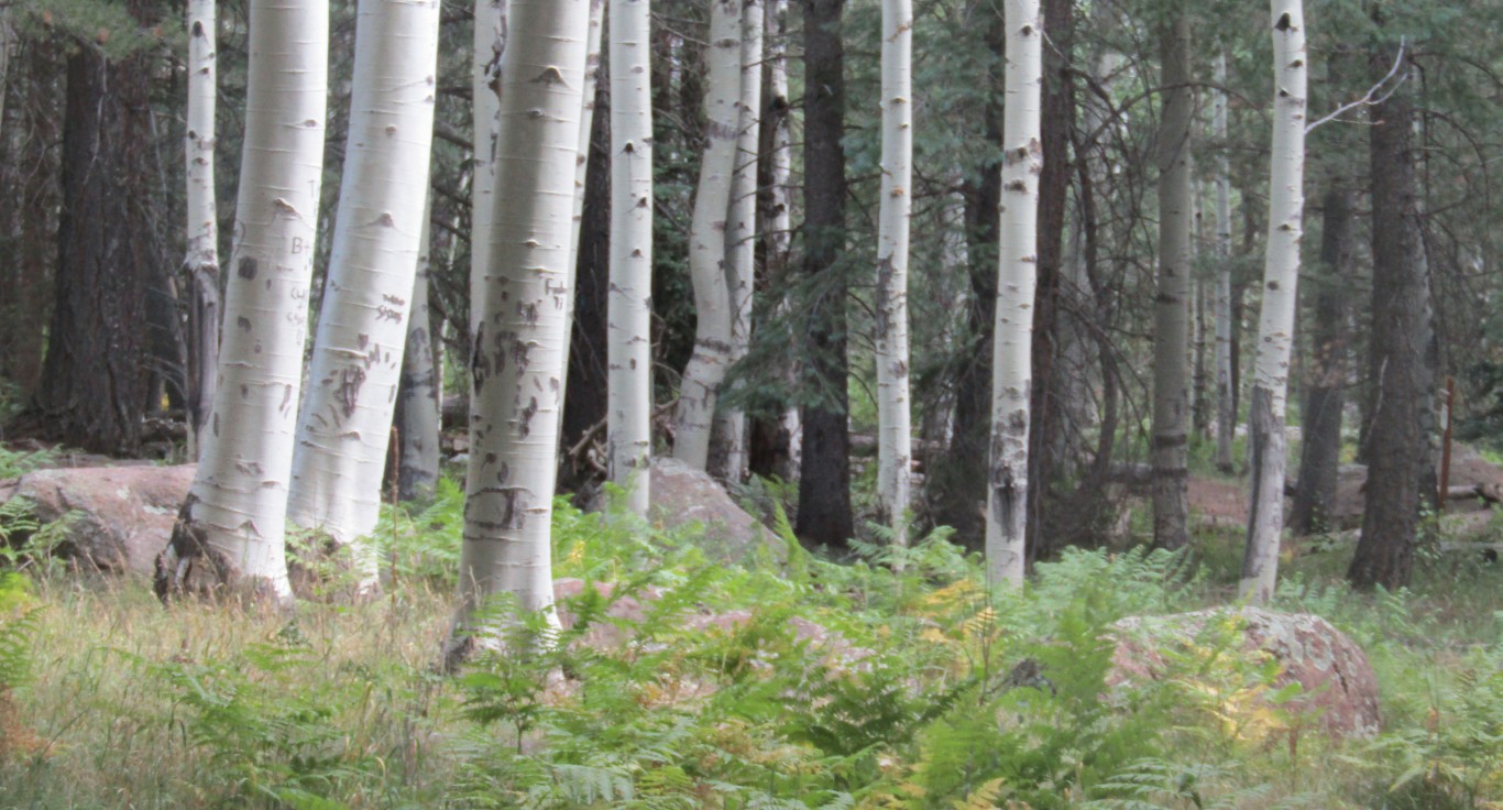
On the hottest days the best hikes are about two hours away, with my preferences in Flagstaff and the Mogollon Rim. I’ve even come out of some of the lower-elevation Flagstaff hikes at over 90 degrees. Marshall Lake to Fischer Point Trail in Flagstaff, out Lake Mary Road, goes from 7,137 feet to 7,708 feet. Again, when it’s 90 degrees in Flagstaff, you may want to go higher. This is why the San Francisco Peaks Trail is my favorite summer-workout trail. This trail, part of the Arizona Trail, rises from 8,928 feet to 9,000 feet. You are up high enough that’s if it’s 90 in Flagstaff it won’t be any hotter than 80 on this trail, and the trail is spectacular for many reasons: the aspens, pines and ferns and its panoramic view of Hart Prairie are the highlights.
I have seen bear, deer and Clark’s nutcrackers on the San Francisco Peaks Trail. It has some minor up and downs, but in general it’s so flat that the 15.2-mile trail will feel like less. Another enticement is there is plenty of shade and a lot of downed trees for snack and lunch breaks.
A nice part to this trail is it’s an in-and-out hike, so you can turn around at any point if you’re not up for the full 15 miles of this segment of the Arizona Trail. There are three natural-landmark turnaround points. At two miles you come to an opening with a great panoramic view of Garland Prairie. If you’ve come this far, you want to go another half mile to enjoy this wide-open view and see the Nature Conservancy’s Garland Prairie Nature Preserve below. This is impressive because it has the largest stand of Bebb’s willow trees in the world, and Basque sheepherders have carved their names into the trees.
The second turnaround spot is at about 3.5 miles, where you can take about a half-mile detour south to the ephemeral Bismarck Lake. The south side has some great boulders where you can hide from the sun and have lunch.
At the five-mile mark is a burned-out tree that lets you know you can turn around at that point and get ten miles.
Water
I can’t emphasize enough the importance of taking enough water with you on hikes during hot days. Each person has to figure out how much water to take based on the heat, elevation, distance your doing and how well you know the trail. If it’s an urban trail or common trail where you know you will see other hikers, you can take a bit less water. If you don’t know the trail, take extra water just in case you get lost.
Hiking clubs advise taking three liters for an eight- to ten-mile hike, even at higher altitudes. Vitamin B and energy chews are also good to take in case you run low on energy.
Usually in this column I like to talk about the beauty, diversity and wonder of great places to hike with the hope that you will go there. This one is about a place you can’t go till at least next spring, unfortunately.
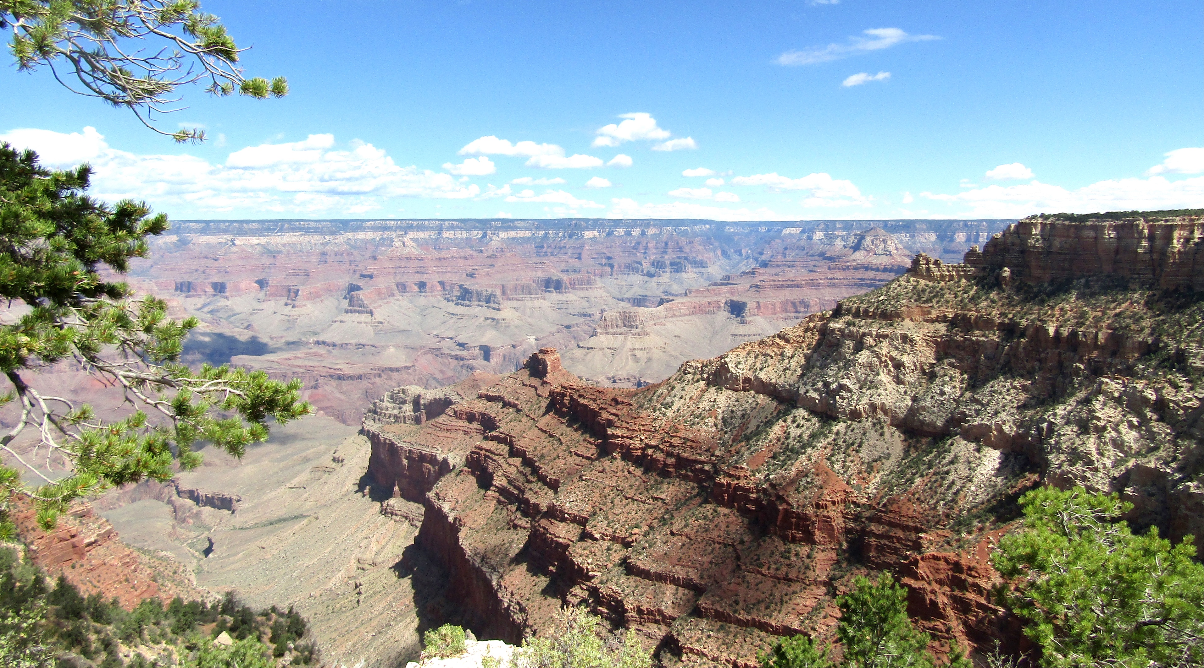
The North Rim of the Grand Canyon, like so many beautiful areas in Arizona, is going through a horrible fire. As I write more than 12,000 acres have burned and it is only about eight-percent contained. The fire’s destroyed 70 structures, including the iconic Grand Canyon Lodge. The North Rim will have to be rebuilt and regrown. Hopefully that will include aspens and milkweed in heavy plantings.
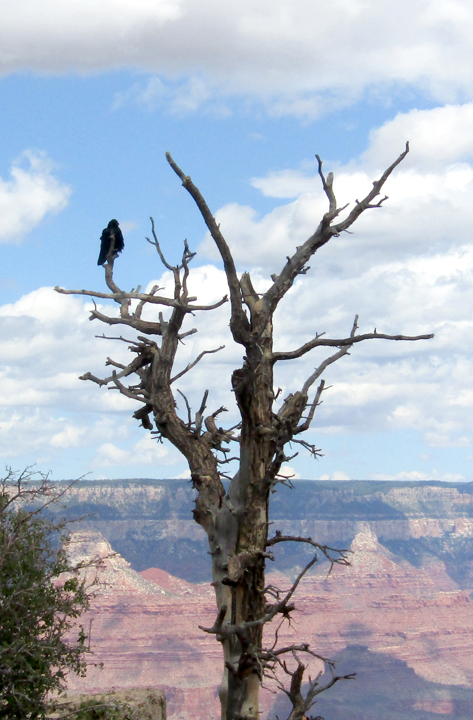
But it will take years. I’ve been to the North Rim a half-dozen times and I have many great memories. I feel bad for the folks who have never seen it. The Grand Canyon is one of the wonders of the world and I’ve always loved the North Rim more than the South Rim — a little more remote, not as many people, and not as commercialized. Love the South Rim; love the North Rim even more.
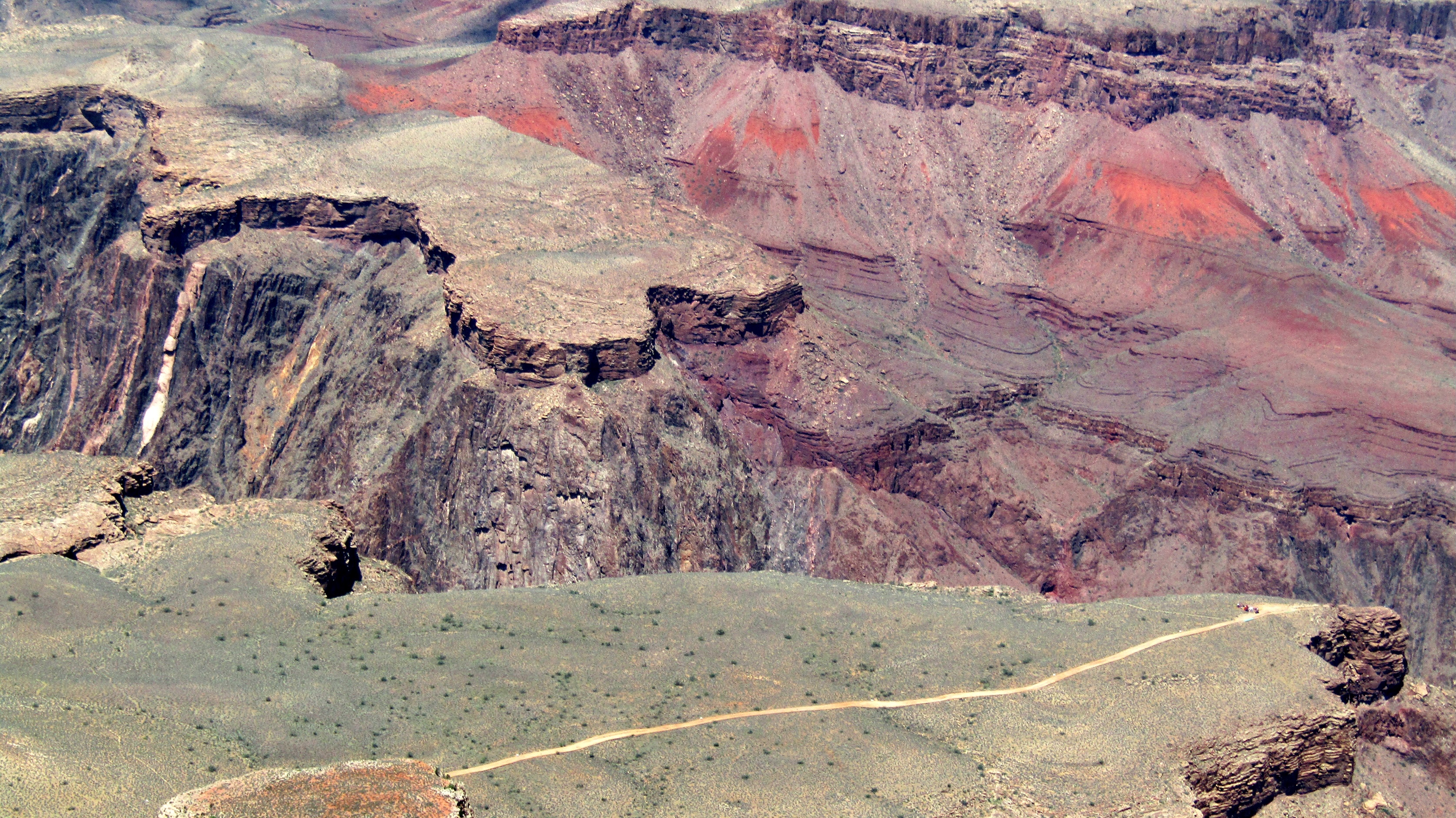
One of the best hikes I’ve ever done was the Thunder River Trail, starting at North Rim. This was back in about 1990, a grueling, four-day, three-night hike. The hike leader, Mike Turner of the Flagstaff Hiking Club, warned that you don’t dare do this hike with bad knees, and you carry a whistle in case you got separated from our little four-person hiking party.
It’s called Thunder River because when you get to your destination at the bottom, the Little Colorado is coming so fast into the Colorado River that it sounds like thunder. It did, so much so that we could hardly hear the voices of our fellow hikers. It was wonderful. Just before the final descent on the Thunder River Trail you pass through Surprise Valley, a wide, open area you don’t want to be in when it’s too hot. The joke among hikers was that it’s called Surprise Valley because if you live through it, it’s a surprise.
More recently I recall 2017, when I stayed at the Jacob Lake Campground with my grandson Nick and we hiked part of the Arizona Trail. This is what I wrote back then:
The Jacob Lake Campground remains a good, inexpensive place to stay because it’s only 45 miles from North Rim and the last location to get food before heading to the Canyon. It’s two miles north of Forest Road 205, where you can pick up Arizona Trail 101, also part of the Kaibab Plateau Trail, just off the road.
This hike is rated easy to moderate, depending on how far you want to go. It’s 12 miles to Highway 67, 17 miles to Forest Road 241, 30 miles to the East Rim viewpoint, and 37 miles to Grand Canyon National Park. Of course, the Arizona Trail from the Mexico border to the Utah border is about 800 miles for those who want the full hike.
We did 10 miles, five miles in and five miles out. This section is mostly Ponderosa pine with many small ups and downs — go up 300 feet, then down 300 feet, repeat often. It’s still not as strenuous as a lot of Arizona’s mountain hikes.
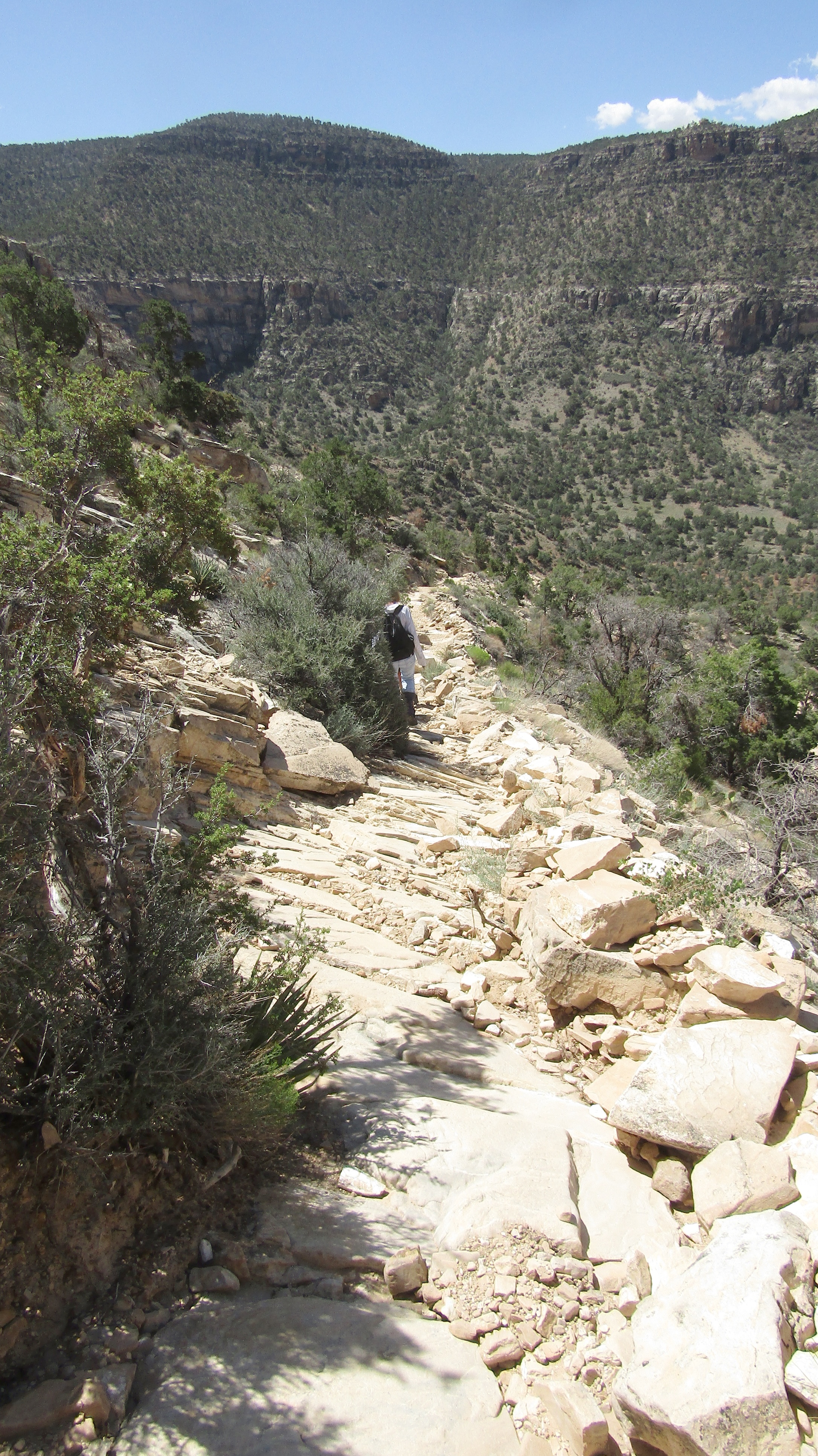
This trail follows an old Forest Service road and often comes to junctions where you have to turn onto another FS road to continue the hike, with no signs to tell which way the Arizona Trail goes. You have to pay constant attention which way you’re turning, it’s easy to get lost on this trail if you don’t.
We spotted several deer and one wild turkey among other wildlife on our trek.
Every North-Rim fan is watching for when we can return and see how it’s changed, but we’re also wondering how we can help.
On its website the Grand Canyon Conservancy states that it is committed to supporting the North Rim through this crisis and into recovery. The group is providing immediate and long-term assistance through the Grand Canyon Disaster Relief Fund. Your gift will help North Rim residents who’ve been displaced, meet critical needs that emerge as the situation evolves, and support the long-term restoration and healing of this iconic landscape.
I also want to thank the firefighters and anyone who is working to protect and restore the North Rim.
The Kendrick Peak Wilderness and Mexican gray wolves aren’t usually mentioned together because the wolves had generally stayed south of I-40, but in the past year that changed, with two wolves making their way there.

Unfortunately the wolf named Hope was mistaken for a coyote and shot. Another, Mystery, is named appropriately because she wandered off and no one knows where she went. But Claire Musser, executive director of the Grand Canyon Wolf Recovery Project, thinks the gray wolves belong here.
“The wolves are telling us and showing us they want to be here,” she said.
Musser says Mexican gray wolves are important to the ecosystem, helping move elk and deer along and keep those populations down. This also helps prevent overgrazing and promotes revegetation.
The wolves’ habitat has been fragmented by climate change, construction and the continuing expansion of highways, so while hiking this scenic trail we wouldn’t expect to see them. Wolves usually keep out of sight of humans. They may be there, you might even feel their presence, but it’s unusual to see them. Musser has studied these wolves extensively, she’s heard them howl and met them in captivity, but never never seen one in the wild.

There are two reasons for taking wolves captive. One is to ensure that the species survives. The other is when they’re badly injured, and in those cases they are placed in protected environments. Such is the case with the wolves at Heritage Park Zoological Sanctuary in Prescott. Southwest Wildlife in Phoenix has similary rescued several wolves, and released them once they were healthy.
Musser says that when wolves are placed in captivity those who work with them have to treat them with special care, because changing their food can negatively affect their quality of life.
While you probably won’t see a wolf on Kendrick Peak, the hike remains among the best in the state, especially this time of year, when the elevation cools us off. Kendrick is the eighth-highest mountain in the state, and the scenery is hard to beat. It’s even better in the fall, when the aspens turn golden.

I had my own wonderful wildlife experience on Kendrick, with elk. On a Flagstaff Hiking Club outing to the Kendrick Mountain Wilderness in the ‘90s there were about ten hikers, and four of us were a bit ahead of the others, so we stopped at the foot of the mountain to wait for the others. We stood among the big trees and ferns, two of us facing the other two. My camera was draped around my neck, which became important.

As I faced the two hikers across from me, an elk appeared out of nowhere behind them. This was amazing considering the size of an elk, even one without a rack. The elk stopped right behind the hikers I was facing. I whispered to them not to move, I raised my camera took a couple quick photos, the elk curled its lip, then ran off, with two young ones right behind. At the time, I was writing for the now defunct Flagstaff Times, and my photo ran on the cover of its Sunday magazine.

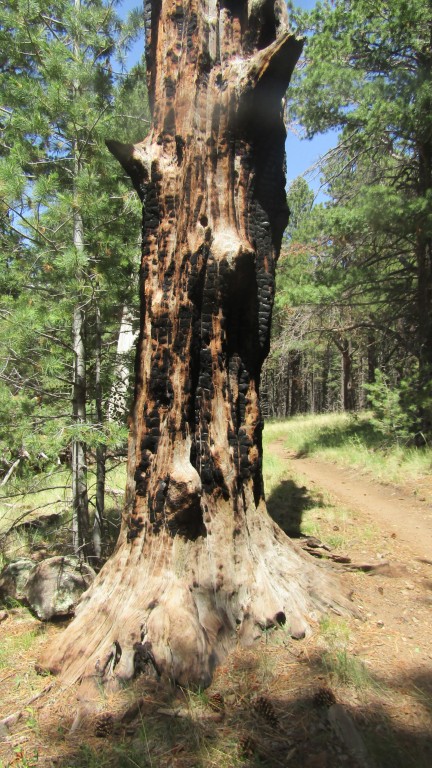
I’ve been back to Kendrick several times since then, and it’s changed somewhat due to fires, but most of its beauty remains intact. In 2000 the lightning-caused Pumpkin Fire burned 15,000 acres, including a good portion of the 6,540 acres of the wilderness area.
In 2017 the Boundary Fire, also lightning-sparked, burned about 400 acres near the top of the peak. This was a concern because of the fuel available in dead and downed trees and forest debris caused by the Pumpkin Fire. This is when the area by a cabin near the top burned, and firefghters were able to save the cabin, a highlight of this trail.

The one-room log cabin was built in 1912 and used to bunk fire lookouts into the 1930s. Years ago the cabin was open and hikers could wander in, but this summer it was locked.
Some rate this trail as moderate, others as hard, so be prepared for the elevation change. For more about Mexican gray wolves, see my video on YouTube.

The Pigeon Trail in the Four Peaks Wilderness sits thousands of feet above the beautiful blue water of Roosevelt Lake, giving hikers great views. A dozen different types of flowers, surrounding mountains and the rugged remoteness make this wilderness area a gem.
The great variety of trees color the Pigeon Trail and Four Peaks Trail in lush green. Periodic boulders add to the enticement.

The trailhead tells hikers that the Pigeon Trail is also part of the 780-mile Arizona Trail, and known to be one of its tougher sections, in part because few hikers come through here, so the overgrown foliage can require some bushwhacking.
Another sign at the trailhead tells hikers that a burn area is ahead. In 1996 two campers left a campfire unattended and it burned 61,000 acres. It was Arizona’s largest fire till 2002. Unfortunately, several forest fires have surpassed it since, reminding us to be careful to avoid starting fires by making sure campfires are out, and that we need to continuously be adamant about preventing forest fires and watching for them.
Just five minutes down the trail is Pigeon Springs. It’s sometimes dry, but due to recent rains there is a foot of water in it. Sometimes it can flood, but it currently doesn’t look like much.

A little further down the trail the Four Peaks Wilderness sign appears, with four branches coming out of the top. One of my fellow hikers wonders whether this is on purpose.
More than two miles in, another spring appears. Veteran hike leader Michael
Humphrey warns everyone that they must use filters before drinking the water.
There are 40 miles of trails on at least 15 routes in the Four Peaks Wilderness. Our group of ten Arizona Trailblazers, a statewide hiking group, takes the Pigeon Trail down before taking the Four Peaks Trail back up. We started at about 5,800 feet and descended to about 5,200 before working our way back up the trail, which had enough scree to keep our attention on our footing.

These two trails had plenty ups and downs, giving us a total elevation change of about 1,800 feet. Most of us meandered about 7.5 miles, but with so many trails hikers can do as much or as little as they want.
Two of the other popular trails are Browns Trail and Amethyst Trail. Browns Trail leads to the top of Browns Peak, the highest point in Four Peaks Wilderness at 7,659 feet. Amethyst Trail leads to an old amethyst mine. Some call this peak Amethyst Peak, but three of the four peaks do not have official names.
Brown’s Peak is the highest point in Maricopa County and a known landmark to those living in the East Valley.
Four Peaks Wilderness was established in 1984 and covers 60,740 acres. From the four peaks you can see about a quarter of the state, including Humphrey’s Peak. The elevation ranges from 1,900 feet near Apache Lake to the top of Brown’s Peak.

The highlands of Four Peaks Wilderness contain Ponderosa pine, Douglas fir and a few aspen stands. The central section offers pinon, manzanita and gamble oak, while the lower section has ocotillo, cholla, saguaro and palo verde. The lower parts can be over 100 degrees in summer, while the higher parts get snow.
This wilderness are hosts one of the densest poplations of black bears in the state. Other wildlife here include ringtailed cats, skunks, coyotes, javelinas, mountain lions, rattlesnakes and scorpions.
Four Peaks Wilderness is one of 90 wilderness areas in Arizona. To learn more about these wilderness areas watch my Preserving Arizona Wilderness series on YouTube. Check this column online for a link to our video about Mexican Gray Wolves in the Kendrick Mountain Wilderness.
Juniper Mesa Wilderness is a rugged area and a bit off the beaten path. Getting to the trailhead is a challenge because the signage on the road isn’t great and there are a few spots along the trail where you can get lost. If lost, just head for the mesa and you eventually come to a fence line that the trail follows.

Don’t expect to find many hikers on the trail; we were there on a Saturday and only met two other hikers.
The trail begins off County Road 125, but you can’t see the sign till after you turn, and if you blink you’ll miss it, as it is weathered and shot-up. Shortly after the sign you’ll pass by the Walnut Creek Center for Education and Research, about seven miles from the trailhead.

Those who find their way there and are able to stay on the trail will find it well worthwhile for the trees: huge alligator junipers. I’ve been on many trails with entertaining alligator junipers, but not any with the multitude of big junipers that the Oaks and Willows Trail in the Juniper Mesa Wilderness offers. One forested area had such large specimens that it was like being in an enchanted forest in a Harry Potter movie.
There is a good variety of other trees along the Oaks and Willows Trail as well. Pinyon pine and Utah juniper dominate the southern slopes of the mesa, while Ponderosa pine and alligator juniper are more prevalent on the northern slopes. Some of the big junipers are a thousand years old. There many kinds of oaks, but here willows are pretty sparse, making one wonder how the trail was named.

Oaks and Willows is one of Arizona Highways’ top 52 day hikes, with the lush forest as the biggest reason.
The trail begins at the north fork of dry Walnut Creek on the George Wood Canyon Trail. You’ll soon come to the junction with the Bull Springs Trail and the Oaks and Willow Trail. Once you reach the fence line you drop down into George Woods Canyon, and the rest of the trail is mostly forested, with some downed logs as good places to rest, snack and lunch.

Much has changed since I was on this trail a few years back. Last time the wilderness sign was standing erect and in typical good shape. This time the years and weather had taken its toll on the sign, and it had fallen off. Someone had put it back up, but it was dangling. I was able to hold the sign before putting it back up a bit more firmly.
Just like the years had its impact on the sign, it also has taken my hiking ability down a few notches. Last time I was here I hiked the 11.5 miles; this time I only did about five miles round-trip.

Part of it was my hiking shape. Part of it was losing the trail for a bit, and part of it was I was with videographer Kyle Ward, shooting video for our next episode of Preserving Arizona Wilderness. Shooting video means frequent stops for video and audio.
On our shorter hike we climbed from 5,600 to 6,400 feet, most of it out in the open; thankfully it was a cool, windy, cloudy day.
The Oaks and Willow Trail tops out at 7,702 feet, offering lots of wildlife and vegetation along the way. The geology is also diverse, with limestone, sandstone, granite and basalt.
The 7,406-acre Juniper Mesa Wilderness was established in 1984 and is managed as part of the Prescott National Forest. The mesa is about an hour's drive northwest of Prescott in the Juniper Mountains.

This remoteness means you are more likely to see the local wildlife, which includes wild turkey, bear, elk, mule deer, bobcat, coyote, gray fox, badger and Abert's squirrel.
Steep canyons cut through the mesa. Views to the south and east include Apache Creek Wilderness and parts of the Granite Mountain, Woodchute, and Sycamore Canyon wilderness areas.
The vegetation includes mountain mahogany, skunkbush and manzanita. There’s plenty of cactus to avoid here as well.
It’s a birder’s paradise, with hawks, golden eagles, yellow-billed cuckoos, songbirds and bats. Keep your eyes peeled for snakes, too — Mexican garter snakes are common here, and rattlesnakes are not out of the question.